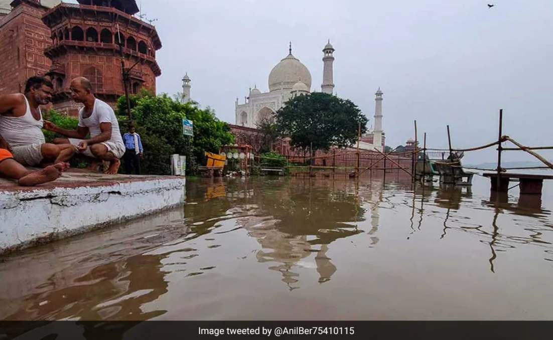
Rising water levels in Yamuna river have caused extensive floods and havoc in several northern cities. The water level has now crossed the ‘low-level flood’ mark of 495 feet in Agra and reached the walls of the Taj Mahal for the first time in nearly 45 years. Such high levels of water have consequently submerged a garden behind the 17th-century monument.

According to local authorities, the Yamuna River reached a height of 497.99 feet. The Archaeological Survey of India (ASI) however has stated that there is no immediate threat to the UNESCO World Heritage site. Some areas surrounding the Taj Mahal, such as the outer parts of Itimad-ud-Daula’s tomb and the Dussehra Ghat, have also been affected as water entered these locations.
As of Monday at 11 pm, the water level of the Yamuna River in Delhi was measured at 206.01 meters, indicating a slight increase compared to the previous gradual decrease in water levels. Several parts of the national capital continue to experience waterlogging.
Delhi is currently grappling with one of its most severe flood-like situations due to heavy rainfall, leading to the evacuation of over 25,000 individuals from inundated areas.
The Central Water Commission (CWC) has reported that the water level, which had breached the danger mark, causing extensive flooding in the city, was recorded at 205.48 meters at 7 am on Monday, a decrease from 206.02 meters recorded at 8 am on Sunday.
District Magistrate Navneet Chahal conducted an inspection of low-lying areas in Agra city on Sunday and instructed officials to make necessary preparations in the event of a flood-like situation.
Preparations have been intensified in villages located along the Chambal River bordering the Agra district, as per an official. The rise in the water level of the Yamuna River in Agra is attributed to the release of water from two barrages in the past 24 hours. Specifically, 1,06,473 cusecs of water was released from the Okhla Barrage, and 1,24,302 cusecs of water was released from the Gokul Barrage in Mathura, where all seven gates have been opened.
According to Archeological Survey of India some other monuments which could be possibly threatened but are not at risk as of now are Rambagh, Mehtab Bagh, Zohra Bagh and Kala Gumbad.
“A river never forgets” – Yamuna returns to its natural course
Since last week, the swelling of the Yamuna River has caused extensive flooding in low-lying areas along its banks, including parts of the national capital, Delhi. The rising water levels ached areas that have not been inundated in decades.
The floodwater from the Yamuna reached a section of the Ring Road between the Red Fort and Salimgarh Fort last week.
Social media posts shared visuals of knee-deep water near the northern walls of the Mughal-era Red Fort contrasting these images with several Mughal-era paintings depicting a similar scene from centuries ago when the Yamuna River flowed naturally in that area are being widely circulated.
Netizens suggested that the Yamuna River is reclaiming its natural course that was altered when the floodplains were encroached upon, filled up, and transformed into urban areas.
Old photographs from the late 1800s were being widely shared on social media showing water from the Yamuna River near the Red Fort, portraying the historical connection between the river and the area currently affected by flooding.


