NASA successfully launched one of its powerful and technologically advanced satellites, Landsat 9, on September 27. The launch took place in Vandenberg Space Force Base in California at 11:42 PM IST.
The U.S. government space agency National Aeronautics and Space Administration (NASA) recently launched Landsat 9 satellite to monitor the Earth’s surface.
The Landsat 9 is a joint venture of NASA and the U.S. Geological Survey (USGS). The Atlas V rocket carried the satellite and successfully detached it after an hour.
The satellite is specifically built to observe the Earth’s surface and analyze the climate changes.
What is a Landsat Program?
Landsat is a joint mission of NASA and USGS to started in 1972 with the launch of the first Landsat satellite ERTS-1, which was later renamed Landsat 1.
The objective of this program is to obtain data from the Earth’s surface to make significant decisions about climate change.
Previous satellites, Landsat 7 and Landsat 8 were launched in 1999 and 2013, respectively. At present, both satellites are active near the polar orbit of our planet.
Landsat 9 is a technologically advanced satellite that will continue providing data with some of its enhanced features.
So far, since the launch of the first Landsat satellite, 8 million images have been amassed. Each pixel in these images is 30-meters across, about the size of a baseball in-field.
Why do we need to monitor the Earth?
Landsat plays an essential role in comprehending the changes that occur on the Earth. The meticulous details provided by satellites which are untraceable manually, allow everyone globally to monitor crucial changes such as the speed of Antarctic glaciers or deforestation in the Amazon rainforest.
Many human activities affect nature in innumerable ways, and Landsat helps to scrutinize these after-effects.
Moreover, other predictable but inevitable disturbances occurring on the Earth, such as insect outbreaks, wildfires, and hurricanes, can be pre-studied with the help of Landsat satellites.
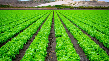
The freely available information identifies the type and distribution of major crops across the globe, measure how agriculture is expanding or shrinking in remote regions, and monitor crop health and the condition of pastures and rangelands.
In addition, other significant information, such as water use, urban expansion, coral reef degradation, and climate change, can be analyzed with this mission.
What is New in the Landsat 9?
The Landsat 9 will precede Landsat 8 launched in 2013, and the satellites together will collect images of Earth’s surface.
The novel satellite essentially replicates Landsat 8 but has two science instruments, a sensor and moderate spatial resolution.
It has the technological ability to assess more colours and detect a higher range in intensity than previous satellites.
The instruments integrated with the Lansat 9 are the Operational Land Imager 2 (OLI-2) and the Thermal Infrared Sensor 2 (TIRS-2).
They will aid in detecting different wavelengths reflecting from the Earth’s surface. Moreover, OLI-2 can capture light that is not visible to the human eye.
TIRS-2 is integrated with a four-element refractive telescope and photosensitive detectors that record thermal radiation and help study the Earth’s surface temperature.
Karen St. Germain, director of the Earth Science Division at NASA Headquarters in Washington, said in a release: “For nearly 50 years, Landsat satellites monitored our home planet, providing an unparalleled record of how its surface has changed over timescales from days to decades. Through this collaboration with USGS, we’ve been able to provide continuous and timely data for users ranging from farmers to resource managers and scientists. This data can help us understand, predict, and plan for the future in a changing climate.”
With the ‘new eye in the sky’, Landsat 9 will continue the legacy of the Landsat program. The innovations upgrading each decade will give a broader perspective on how the Earth has changed since humans existed.
Though nature and humans have been co-existing since anyone remember, our home planet is going through many changes caused by human activities.
Hence, with the growing population and demand, it is crucial to track these inevitable changes.


